
Navigating the vast expanse of the ocean is a skill that has been essential to sailors for centuries. Understanding the basics of marine navigation is crucial for any seafarer, whether you are a seasoned captain or a novice sailor setting out on your first voyage. In this article, we will delve into the fundamental principles and tools of marine navigation that every mariner should be familiar with.
**The Importance of Marine Navigation**
Marine navigation is the process of safely guiding a vessel from one point to another on the water. It involves determining the position of the ship, plotting a course, and avoiding hazards such as rocks, reefs, and other vessels. Accurate navigation is vital to ensuring the safety of the crew, passengers, and cargo on board.
**Understanding Nautical Charts**
One of the primary tools used in marine navigation is the nautical chart. Nautical charts are specialized maps that provide detailed information about the waterways, including water depths, currents, tides, and navigational aids. These charts are essential for planning a route and avoiding obstacles along the way. Mariners must be able to interpret nautical charts effectively to navigate safely.
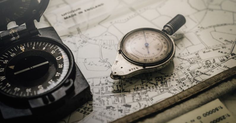
**Compass Navigation**
The compass is another critical instrument in marine navigation. The compass provides a reliable reference point for determining the direction in which the ship is traveling. By combining the information from the compass with other data, such as the position of the sun or stars, mariners can plot their course accurately and maintain their heading even in adverse conditions.
**Electronic Navigation Systems**
In modern times, electronic navigation systems have revolutionized the way ships navigate the seas. GPS (Global Positioning System) is now a standard tool on most vessels, providing real-time information about the ship’s position with pinpoint accuracy. Electronic chart plotters and radar systems further enhance navigation by displaying the vessel’s position relative to other objects and potential hazards.
**Dead Reckoning**
Dead reckoning is a traditional method of navigation that involves calculating the ship’s position based on its previous known position, course, speed, and time traveled. While modern technology has reduced the reliance on dead reckoning, it remains a valuable skill for mariners, especially in situations where electronic systems may fail.
**Navigational Aids**
Navigational aids are markers and signals placed along waterways to assist mariners in navigating safely. These aids include lighthouses, buoys, beacons, and lighted markers that provide critical information about the location of hazards, channels, and other navigational points. Understanding and interpreting these aids is essential for safe navigation.
**Celestial Navigation**
Celestial navigation is a traditional method of determining a ship’s position using celestial bodies such as the sun, moon, and stars. While less commonly used today due to the prevalence of electronic systems, celestial navigation remains a valuable skill for mariners, especially in situations where other methods may be unavailable.
**Conclusion: Navigating with Confidence**
Mastering the basics of marine navigation is essential for anyone venturing out to sea. By understanding nautical charts, compass navigation, electronic systems, dead reckoning, navigational aids, and celestial navigation, mariners can navigate with confidence and ensure the safety of their vessel and crew. Whether you are a professional sailor or a recreational boater, investing time in learning and practicing these fundamental skills will enhance your ability to navigate the open waters effectively.