
Navigating by the stars using a sextant is a skill that has been practiced for centuries by sailors and explorers. While modern technology has made navigation easier with GPS systems, learning how to use a sextant can be a rewarding experience and can come in handy in situations where electronic devices may fail. In this article, we will explore the art of navigating using a sextant and provide you with the essential knowledge to master this ancient technique.
Understanding the Sextant
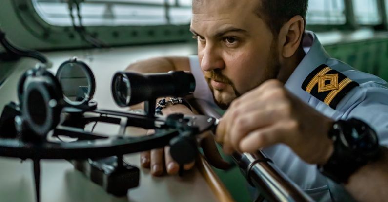
The sextant is a navigational instrument that is used to measure the angle between two objects, typically a celestial body such as the sun, moon, or stars, and the horizon. This angle, known as the altitude, can then be used to determine the observer’s position on the Earth’s surface. The sextant consists of a frame with a graduated scale, a sighting mechanism, and a mirror that reflects the image of the celestial body onto the scale. By aligning the image of the celestial body with the horizon, the navigator can accurately measure the altitude.
Calibrating the Sextant
Before using a sextant for navigation, it is essential to calibrate the instrument to ensure accurate readings. Start by checking the index error, which is the difference between the actual reading and zero on the scale when the sextant is at rest. To do this, point the sextant at a distant object and adjust the index arm until the image of the object lines up with the horizon. The difference between the reading and zero is the index error, which should be noted and accounted for in all subsequent measurements.
Taking a Sight
To take a sight using a sextant, start by locating the celestial body you wish to measure, whether it’s the sun, moon, or a star. Hold the sextant steady and align the image of the celestial body with the horizon by adjusting the index arm. Once the image is aligned, read the altitude off the scale. Be sure to take the measurement at the exact moment when the image is in perfect alignment with the horizon to ensure accuracy.
Calculating Your Position
Once you have taken a sight of a celestial body, you can use the altitude measurement to calculate your position on the Earth’s surface. This process involves a series of mathematical calculations that take into account the time of the observation, the declination of the celestial body, and the observer’s latitude. By combining these factors, you can determine your position with a high degree of accuracy.
Practice Makes Perfect
Like any skill, mastering the art of navigating with a sextant takes practice. Start by practicing in clear weather conditions during the day when celestial bodies are visible. As you become more comfortable with the instrument, you can challenge yourself by taking sights at different times of the day or night and in varying weather conditions. By honing your skills through practice, you will become more confident in your ability to navigate using a sextant.
Embracing the Ancient Art of Navigation
While modern technology has revolutionized the way we navigate the world, there is something special about embracing the ancient art of navigation with a sextant. By learning how to use this traditional instrument, you can connect with the seafarers and explorers of the past and gain a deeper appreciation for the skills and knowledge required to traverse the seas. So, next time you find yourself under the open sky, consider taking out your sextant and navigating by the stars—it may just lead you on an adventure of a lifetime.